- Page d'accueil /
- Sports Outdoor & Fitness /
- Outdoor Recreation /
- Camping & Hiking /
- Navigation & Electronics /
- Topographic Maps /
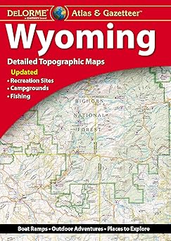
- Delorme Atlas & Gazetteer: Wyoming Paperback ...
0 ratings

Numéro d'article:
128913838
Delorme Atlas & Gazetteer: Wyoming Paperback Atlas, October 3, 2024
Numéro d'article:
128913838
MGA 146857
Price Details
Excluding Shipping & Custom charges ( Shipping and custom charges will be calculated on checkout )
*All items will import from États-Unis
0 ratings
Écrire un commentaire
En stock
 Importé depuis la boutique USA
QTY:
Commandez maintenant et recevez votre commande aux alentours du Monday, Juillet 27
Transaction sécurisée
Ubuy s'engage à protéger votre sécurité et votre confidentialité. Notre système avancé de sécurité des paiements garantit la confidentialité en chiffrant vos informations lors de la transmission grâce aux protocoles AES (Advanced Encryption Standards) et SSL (Secure Socket Layer). Vos coordonnées de paiement sont 100 % sécurisées car nous ne partageons pas vos informations de paiement avec des vendeurs tiers.
Nos meilleurs partenaires logistiques


With an incredible wealth of detail, DeLorme's Atlas & Gazetteer is the perfect companion for exploring the Wyoming outdoors.

Livraison
rapide

Retour
gratuit*

Emballage sécurisé

Produits 100 % originaux

Conformité PCI DSS

Certifié ISO 27001


Ce qui se démarque
Comprehensive Mapping
Offers detailed topographic maps of Wyoming, ideal for outdoor enthusiasts seeking accurate navigation through remote areas.
Local Insights
Includes extensive information about parks, trails, and recreation areas, providing users with valuable insights for planning their adventures.
Durable Construction
Crafted with high-quality materials, ensuring resilience against outdoor elements while remaining user-friendly for frequent use.
Détails du produit
| Item Weight | 1 lbs (450 grams) |
À qui est-ce destiné ?

-
Outdoor Enthusiasts
Perfect for hikers and campers needing detailed terrain maps and local features for outdoor adventures in Wyoming.
-
Travel Planners
Ideal for those planning road trips who require comprehensive maps and information about scenic routes and attractions.
-
Local Researchers
Useful for students or historians interested in studying Wyoming's geography and historical landmarks through detailed cartography.

-
Digital Navigators
Not suitable for users who prefer GPS or online maps over traditional paper maps for navigation.
DESCRIPTION DU PRODUIT
Delorme Atlas & Gazetteer: Wyoming Paperback Atlas, October 3, 2024
Vous avez une question ? Chattez avec nous
Questions et réponses des clients
-
question:
What is the Delorme Atlas & Gazetteer: Wyoming?
répondre: The Delorme Atlas & Gazetteer: Wyoming is a detailed map book designed for outdoor enthusiasts, featuring comprehensive topographic maps, road maps, and land-use information. It provides users with essential navigation tools, including GPS coordinates, hiking trails, and points of interest. This atlas is especially useful for campers, hikers, and off-road adventurers looking to explore Wyoming's vast natural landscapes. With high-quality cartography, it allows for precise navigation and planning, ensuring that users can safely and effectively discover the beauty of Wyoming. -
question:
Who can benefit from using the Delorme Atlas & Gazetteer: Wyoming?
répondre: Anyone who enjoys outdoor activities, such as camping, hiking, fishing, or exploring remote areas, can benefit from using the Delorme Atlas & Gazetteer: Wyoming. It is especially designed for outdoor enthusiasts and travelers seeking a reliable navigation tool. Whether you are planning a trip to national parks, remote hiking trails, or backroads, this atlas provides the detailed maps and insights needed for successful adventures in Wyoming's rugged terrain. Additionally, it can help families, solo travelers, and groups identify safe routes and points of interest. -
question:
What types of maps are included in the Delorme Atlas & Gazetteer: Wyoming?
répondre: The Delorme Atlas & Gazetteer: Wyoming includes a variety of maps, such as topographic maps, road maps, and land-use maps. Each map is designed to provide detailed information about the landscape, elevation changes, and public and private land boundaries. Additionally, users can find information about recreational areas, trails, and other points of interest. This variety allows for comprehensive trip planning, catering to both serious hikers and casual road trippers who wish to explore the state’s scenic drives and natural attractions. -
question:
Is the Delorme Atlas & Gazetteer: Wyoming waterproof?
répondre: The Delorme Atlas & Gazetteer: Wyoming is not waterproof, but it is printed on durable paper that can withstand typical outdoor conditions. To protect it from the elements during outdoor activities, consider using a map case or pouch. Such protection will ensure its longevity, making it a reliable companion for various adventures. While it’s essential to keep it dry, having a sturdy atlas is crucial when navigating the vast wilderness, as it may not be a suitable option to rely solely on electronic devices in remote areas. -
question:
Can the Delorme Atlas & Gazetteer: Wyoming be used with GPS devices?
répondre: Yes, the Delorme Atlas & Gazetteer: Wyoming can be used in conjunction with GPS devices. It features GPS coordinates for various landmarks and trails, which makes it convenient for users to input these coordinates into their GPS devices for precise navigation. This combination enhances overall navigation capabilities. For instance, outdoor enthusiasts can plot their routes ahead of time on the atlas and then use their GPS to follow them accurately in the field, ensuring that they stay on track during their adventures. -
question:
Are there any updates to the maps in the Delorme Atlas & Gazetteer: Wyoming?
répondre: The Delorme Atlas & Gazetteer: Wyoming is released periodically to reflect changes in road systems and points of interest. While some features may remain consistent, it's critical to check for the latest edition to ensure the most current maps. This is particularly important for those planning to explore lesser-known trails or areas, as conditions and accessibility may change. By choosing the latest version, you gain access to the most accurate information, enhancing your overall navigation experience in Wyoming’s diverse environments. -
question:
How is the quality of the maps in the Delorme Atlas & Gazetteer: Wyoming?
répondre: The maps in the Delorme Atlas & Gazetteer: Wyoming are known for their high quality and detailed representation of the landscape. They are specifically designed for outdoor navigation and feature various elements such as elevation contours, road networks, and notable points of interest. The clarity and level of detail provided allow outdoor enthusiasts to identify trails, campsites, and scenic viewpoints easily. This map quality greatly enhances users' ability to explore Wyoming’s majestic scenery effectively, making it an invaluable resource for any outdoor journey. -
question:
What are some features of the Delorme Atlas & Gazetteer: Wyoming?
répondre: The Delorme Atlas & Gazetteer: Wyoming boasts features such as detailed topographic maps, GPS coordinates, recreational area highlights, and points of interest including parks and campgrounds. It also includes information on public land boundaries, making it easy for users to navigate through both public and private lands. These features make it an excellent tool for planning outdoor activities. Whether you're scouting for new hiking trails or planning a camping trip, this atlas equips you with the essential information needed for a successful adventure. -
question:
What should I consider when using the Delorme Atlas & Gazetteer: Wyoming?
répondre: When using the Delorme Atlas & Gazetteer: Wyoming, it's essential to familiarize yourself with the map scale and legend to maximize its effectiveness. Understanding how to interpret the symbols and contours will enable you to plan your routes accurately. Additionally, always cross-reference your atlas with reliable information sources, especially in remote areas where conditions can change rapidly. For optimal usability, keep the atlas within reach during outdoor excursions to assist in navigation and decision-making, ensuring a safer exploration experience. -
question:
Where can I buy the Delorme Atlas & Gazetteer: Wyoming?
répondre: You can purchase the Delorme Atlas & Gazetteer: Wyoming from Ubuy, an online shopping platform that offers a wide selection of products. Ubuy provides a convenient shopping experience with comprehensive product descriptions and reliable service, ensuring that you find the atlas you need for your travels. By buying from Ubuy, you can easily access this essential resource for navigating the beautiful landscapes of Wyoming and planning your next outdoor adventure.
Topographic Maps Editorial Review
Aucune critique éditoriale trouvée
Avis et évaluations clients
1 évaluations des clients
-
5 étoile
100%
-
4 étoile
0%
-
3 étoile
0%
-
2 étoile
0%
-
1 étoile
0%
Donnez votre avis sur ce produit
Partagez votre avis avec d'autres clients
Platform Trust & Buyer Confidence

MT
Mohd
Verified buyer
“The product received very good packaging & safe…Thank You”
16 June 2026 · via Trustpilot
SJ
Shawati
Verified buyer
“Accurate delivery timing given”
16 June 2026 · via Trustpilot
YB
Youcef
Verified buyer
“Not madly expensive like I thought, and much quicker than promised.”
15 June 2026 · via Trustpilot
LM
Leila
Verified buyer
“Never dealt with Ubuy before, but everything worked out great. Seamless cross border purchasing and shipping. Thanks!”
6/7/2026 · via Trustpilot
KA
Kwame
Verified buyer
“The process was smooth, with clear communication and timelines. This was my 1st purchase and I am really impressed. I will definitely be coming back.”
12 June 2026 · via Trustpilot
Paiement sécurisé
Global Delivery
Easy Returns
Genuine Products
Historique des prix du produit
Informations importantes
- Limitations : Pour les produits expédiés à l'international, veuillez noter que toute garantie du fabricant peut ne pas être valide ; les options de service du fabricant peuvent ne pas être disponibles ; les manuels, instructions et avertissements de sécurité des produits peuvent ne pas être dans les langues du pays de destination ; les produits (et les matériaux qui les accompagnent) peuvent ne pas être conçus conformément aux normes, spécifications et exigences d'étiquetage du pays de destination ; et les produits peuvent ne pas être conformes à la tension et aux autres normes électriques du pays de destination (nécessitant l'utilisation d'un adaptateur ou d'un convertisseur le cas échéant). Il incombe au destinataire de s'assurer que le produit peut être importé légalement dans le pays de destination. En cas de commande auprès d'Ubuy ou de ses filiales, le destinataire est l'importateur officiel et doit se conformer à toutes les lois et réglementations du pays de destination.
- Tous les produits listés sur Ubuy ne sont pas à vendre, Ubuy étant un moteur de recherche mondial. Les produits sont soumis aux réglementations en matière d'exportation et de commerce.
MGA 146857
Commandez maintenant et recevez votre commande aux alentours du Monday, Juillet 27
This item is not restrict in my country.(Please click on above link if this item is not restrict in your country, So our team will review and allow.)
QTY:
Transaction sécurisée
PCI DSS compliant and ISO 27001:2022 certified, with encrypted payments and full buyer protection on every order.
Nos meilleurs partenaires logistiques
Livraison transfrontalière la plus rapide
Caractéristiques et avantages
- Detailed, large-format paper maps for outdoor enthusiasts.
- Includes topographic maps with elevation contours and major road information.
- Features points of interest like parks, campgrounds, and scenic drives.
- Extensively indexed for easy navigation.
- GPS-compatible with latitude/longitude overlay grid.
- Available in paperback for all 50 states.
Ubuy Assurance
Experience worry-free shopping with 100% original products, PCI DSS-compliant payment security, ISO 27001-certified data protection, the fastest cross-border delivery, free returns *, and secure packaging on every order.